MENU
The geology of the area traversed by Charles Sturt’s Central Australian Expedition has been documented in a touring guide written by experienced geologists Bob Brown and Nancy Vickery.
In some detail, travellers to the region can follow the maps and descriptions of the guide to learn and experience yet another fascinating aspect to visitation in the Corner Country. This particular tour also takes in Silverton.
The Broken Hill Complex Bioregion occupies a considerable land area and extends north, north-west and east from Broken Hill. Whilst the bioregion includes ranges such as the Scropes, Mootwingee and Wonnaminta, it is the Barrier Range and the lower hills of the Grey Range, that are most dominant in the Corner Country.Many of the ranges are bounded by long faults producing prominent escarpments and deep gorges on the margins, whilst jump-ups and mesas occur in areas in the north west.
Broken Hill Bio-region – pdf
Travelling through the region one becomes aware of a continually changing landscape.
Generally the ranges dominate, locally replaced by open saltbush-covered gibber plains, or sheets of red sand-hills.
The landscape is commonly crossed by red-gum and box tree-lined sandy creek beds. After rain these can turn to raging watercourses which drain their silt.coloured waters into local lakes and swamps. Some watercourses flow into larger lake systems, such as Bancannia and Bullea. Most are associated with the Murray-Darling Basin.
Sandstone jump-ups and mesas occur throughout the northwest of the bioregion. Further south, gold-bearing quartz and associated slates occur in the region extending from Mt Browne to Tibooburra.
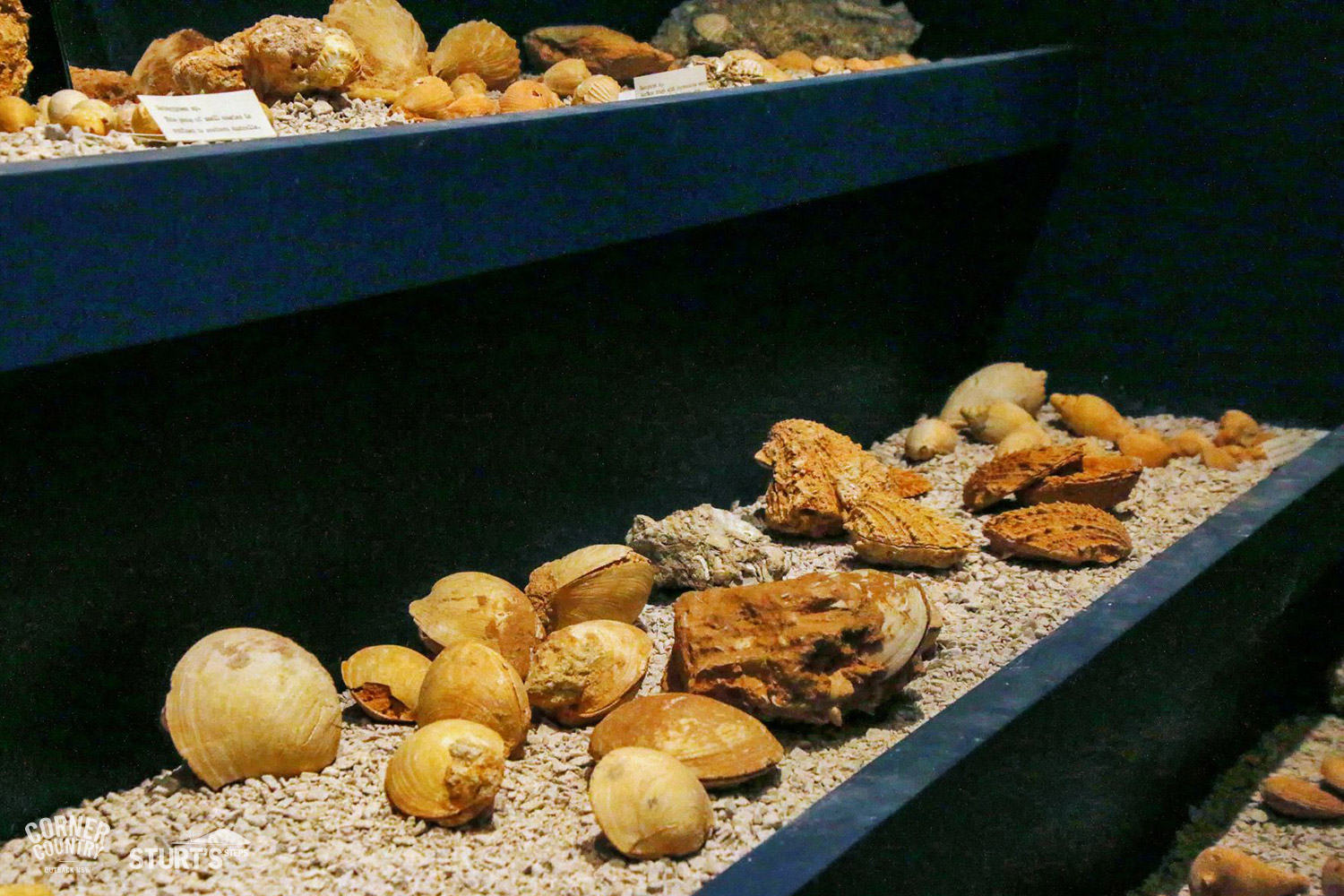
The rocks are amongst the oldest in Australia, the land.scape reflecting the effect of many processes over the 2000 million years of earth history.
Despite low annual rainfall, substantial plant life sup.ports a sheep and cattle industry that has been sustained for almost 150 years, as well as significant numbers of birds and animals.
The most common trees across the bioregion are the acacia species especially mulga, but also river red gum, black box, bullock bush, black oak, hakea, gidgee and bloodwood.
One of the effects of land-use has been the spread of invasive native shrubs. In some areas shrubs such as hop-bush, emu-bush and cassia, are so prevalent that they prevent the growth of native grasses and forbs.
Never-the-less, the region does produce grasses such as Mitchell, button, wire, bottle-washer, as well as perennial never-fail and woolybutt.
A myriad of wildflowers, including some which grow only in the area, make for a rich carpet of colour in late winter and early spring.
Attracted by water, seeds and insects, many native birds make their homes in the bio-region, either permanently or on a seasonal basis.
Birds such as emus, willy-wagtails, budgerigahs, mulga parrots, wedge-tail eagles and bronze-wing pigeons join the rarer native pratincoles, gibber birds, and gull-billed terns. The region also has many reptiles, from the common sleepy lizard, bearded dragons, geckoes, and goannas, to brown and mulga snakes.
Large mammals such as the western red kangaroo, occupy the open plains, whilst eastern grey kanga.roos and the smaller wallaby species, prefer the shelter of the ranges. An occasional find is an echidna, and rarely, tiny marsupial mice.
The goldfields of the Albert District lie within two areas of rocky ranges of slate surrounded by undulating country of the Cretaceous formation. For around forty years, from 1880 to the early 1920s, gold was mined across the Albert Fields. The alluvial fields were the most significant, and were located near the Mt Browne Range and The Granites. Reef gold was mined in the quartz veins around the Warratta Creek.
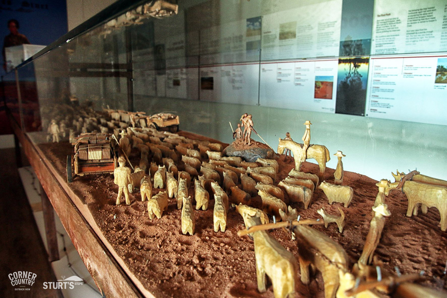
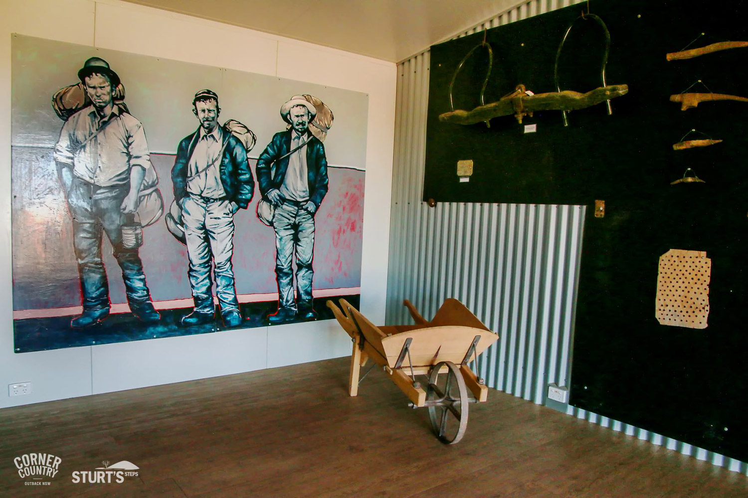
Most of those who rushed to the new fields of the Albert Gold District were ill prepared for the conditions. They started, with their picks and shovels, and Miner’s Right, on a journey of more than 300 kilometres into an area only recently explored, and described by Sturt as a “stoney, waterless waste”. Once there they set up their tents or built a hut, pegged their claim, and set to work.
Despite the conditions, within three months of gold being discovered at Mount Browne, a mining area of around 1000 square kilometres had been opened up. The lack of water in the area limited the camping areas to sites near waterholes.
Apart from the lucky discovery of surface nuggets, gold had to be extracted from the wash dirt in which it was contained. On The Granites’ field the ancient river bed lay just below the ground surface. Generally working in pairs, and with little equipment other than picks and shovels, the miners began by removing the wash-dirt, and piling it for washing.
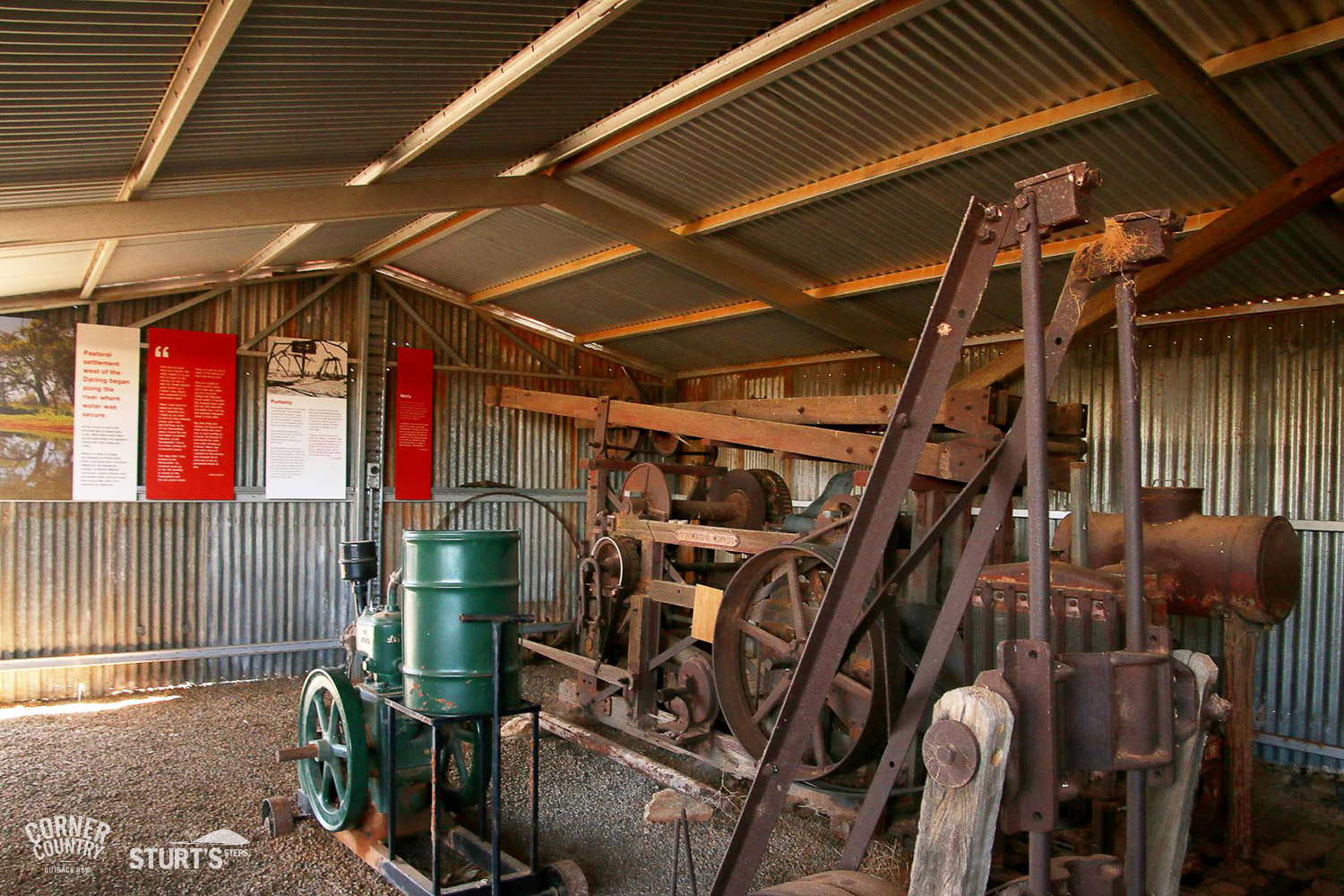
At Mount Browne operations were different. In most cases the alluvial beds were some distance below the surface and miners had to sink shafts in order to reach bed rock. They began by digging and shovelling, mounding the dirt in piles on the edge of the shaft.
As the mound rose they supported the walls of the shaft with timber, to prevent cave in. As they dug deeper a windlass was constructed above the shaft. Winding a rope and bucket into the shaft one miner would stay up top, whilst the other below, filled the bucket with dirt. Once filled it was wound up to the surface, the dirt tipped out, and the procedure repeated.
Extracting the gold from the pay dirt largely relied on the presence of water. Puddling machines were used extensively at The Granites, and crushing machines and puddlers were located at Mount Browne.
Dry blowers, though inefficient, were operated on both fields, and at the very least enabled miners to continue operations even when prohibited by the lack of water.
Quartz ore needed to be crushed. Some claims built their own crushing equipment, such as the twelve headed stamper that was installed near Warratta, but often the operations were beset with incompetent management, faulty machinery, or a lack of water. Some operations were publicly floated in order to raise capital for equipment.
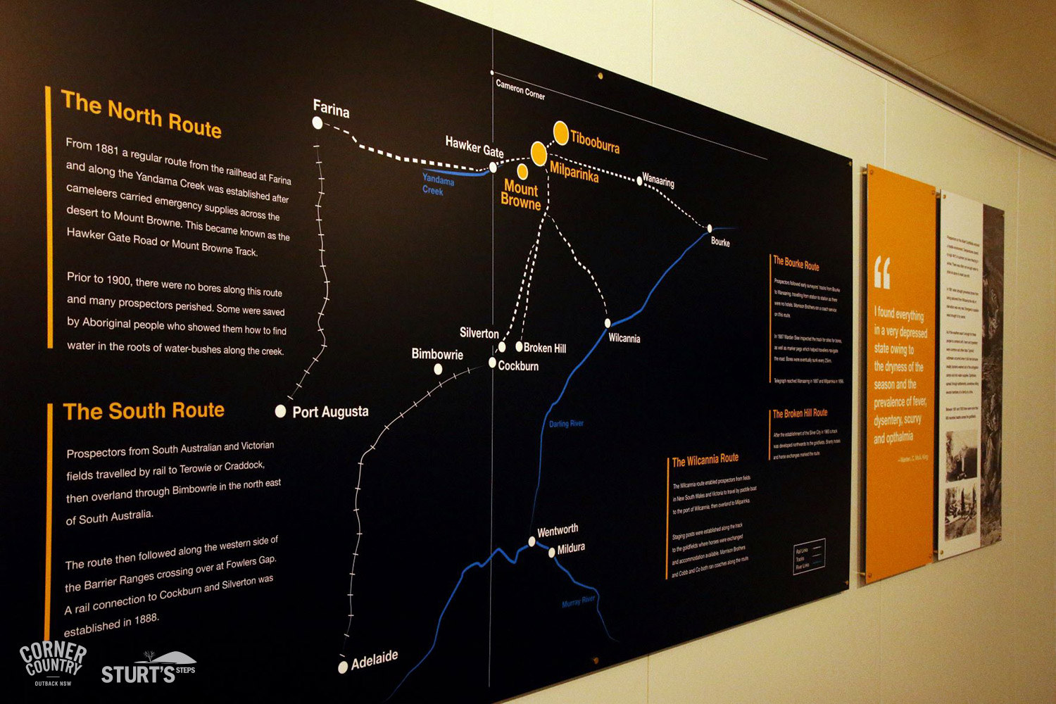
Conditions on the Albert Goldfields were unquestionably worse than at any other field in New South Wales. Continued drought also created major problems for the supply of rations for the goldfields. River boats were unable to reach Wilcannia, and horses were unable to travel from Wilcannia.
Miners literally ran out of food and were starving. A state of emergency was called and Thomas Elder sent a string of camels from Beltana in South Australia, loaded with food and provisions. The cameleers were predominantly Afghani.
In 1882 Camels were also sent to the rescue of the miners when typhoid fever and other ill- nesses swept through the camps. Temporary hospitals were established at Milparinka and Tibooburra, and a Doctor Wilkie was engaged to help with the sick. A “camel-load” of men was also sent away to Wilcannia, where “all recovered their health.”
In time camels became a significant feature of the transport industry of the far west of New South Wales, operating for many years from Farina, on the Marree railway line, Wilcannia, Bourke and Broken Hill. They carried stores to the mine fields and station properties, and wool from the area to be sold, mostly in Adelaide.
The Albert Goldfields also had their fair share of Chinese miners who were, curiously, recorded separately from Europeans on the annual mining reports. The shortage of water for mining and domestic use must have caused considerable friction amongst miners, so much so that there were reports of Chinese miners, having used some quantity of water for personal hygeine, were run out of town, and their hut burned to the ground.
The Chinese were also shop keepers, servants but most importantly, gardeners. With hundreds of people on the goldfields, and little or no access to fresh food, the ingenuity and capacity for hard work saw the Chinese develop vegetable gardens.
In Milparinka the gardens were located on the floodplains of the Evelyn Creek, and it is probable that they also accessed water from a well established by the Government, about 2 kilometres north-east of Milparinka. At Tibooburra they were reported to have used water from the town bore, and in 1882 were recorded to have “been very successful in their operations, and have kept the residents supplied with vegetables at a reasonable rate, and to this may in a great measure be attributed the healthy state of the field. They have successfully proved that potatoes can be grown here, and next year they will have peaches, pears and grapes in bearing”
WINDLASS, WHIP AND WHIM
A windlass is a simple lifting machine generally made from wood. Supported by an axle, the windlass was attached to wooden uprights and centred over the mine shaft. Crank handles at both ends enabled the windlass to be turned. A rope was wound over the windlass shaft, to which a bucket was attached. As the windlass was turned the bucket was lowered into the shaft and filled with the wash dirt. The process was reversed and the wash dirt lifted to the surface.
A whip was also used expensively on the Albert Goldfields. It was made by fixing a long timber pole at an angle of about 45 degrees to the ground. It’s end projected over the shaft.
Attached to the end of the pole was a grooved wheel through which one end of a rope passed into the shaft. A bucket was suspended from the rope. The other end of the rope was harnessed to a horse. As the horse walked away from the shaft the rope and bucket were lifted out of the shaft. The bucket was emptied, the horse turned around and walked toward the shaft. The bucket then descended back into the mine.
A whim was somewhat more complicated, and essentially used for the same purpose. Above the mineshaft a substantial frame was constructed which held a revolving drum in position. Ropes were attached to the drum, and raised and lowered into the mine.
The drum was turned by a horse harnessed to a long pole and attached to beams extending from beneath the drum. Instead of back and forward motion the horse walked in a circular pattern around the mine shaft.